The Southside Action Plan area covers about 14,300 acres south of downtown with about 17,400 addresses in six ZIP codes. Most are zoned for Rickards High.
Last checked Oct. 10, 2026. Sources: the Tallahassee-Leon County 2050 Comprehensive Plan, Land Use and Mobility Element, Objective 3.2 and Map 8; Tallahassee-Leon County GIS open data (Southside Action Plan, neighborhood registry, address point, school zone, park and trail layers); the Florida Department of Education’s 2026 school grades; Zillow Research; StarMetro’s route pages and OpenStreetMap.
The Southside is the large part of Tallahassee south of downtown. Our boundary is the Southside Action Plan area, about 14,300 acres, which the city and county map in their 2050 Comprehensive Plan (Map 8). The plan’s Southside objective calls for “small scale visible improvements” and names three areas of focus: beautification, investment, and engaged and activated citizens. It takes in about 20 registered neighborhood associations, so this page is an overview of many places.
What this means for you
- Zoned high school: Rickards High for about three quarters of addresses (C for 2026). Check an address with the School Zone Lookup.
- Home value: $195,582 in ZIP 32305 and $181,703 in 32310 in August 2026, according to the Zillow Home Value Index.
- Nearest I-10 exit: Exit 199, U.S. 27 (North Monroe Street), about 5.5 miles by road from the middle of the area.
Part of our Tallahassee neighborhoods guide.
Where it is
On the plan map, the Southside runs from about West Pensacola Street and the south edge of downtown south to Capital Circle and Crossway Road. Its busiest streets, from Leon County’s address map, are Jackson Bluff Road, South Adams Street, Roberts Avenue, Magnolia Drive, Ridge Road, West Pensacola Street, Holton Street, Country Club Drive and Lake Bradford Road.
The county places about 17,400 addresses inside it. About 83% are in the city and 17% in unincorporated Leon County. By ZIP code: 32305 about 32%, 32310 29%, 32301 22%, 32304 14%, and small shares in 32307 and 32311. About two in five carry a unit number, which on the county’s map marks apartments, condos and offices.
Schools
The Southside is split among many zones. From a sample of county address points checked against Leon County Schools’ zone maps:
| Level | School | Address | Share of addresses | 2026 grade |
|---|---|---|---|---|
| Elementary | Bond Elementary | 2204 Saxon St. | about 35% | A |
| Elementary | Sabal Palm Elementary | 2813 Ridgeway St. | about 20% | B |
| Elementary | Oak Ridge Elementary | 4530 Shelfer Road | about 19% | C |
| Elementary | Pineview Elementary | 2230 Lake Bradford Road | about 19% | B |
| Middle | Nims Middle | 723 W. Orange Ave. | about 71% | D |
| Middle | Fairview Middle | 3415 Zillah St. | about 19% | A |
| Middle | Cobb Middle | 915 Hillcrest St. | about 10% | A |
| High | Rickards High | 3013 Jim Lee Road | about 77% | C |
| High | Leon High | 550 E. Tennessee St. | about 14% | B |
| High | Godby High | 1717 W. Tharpe St. | about 9% | Incomplete |
About 7% of addresses go to Hartsfield Elementary (B). Godby’s 2026 grade was incomplete in the state’s results; it earned a C in 2025. Check each address with the School Zone Lookup. More is in our schools guide.
Home values
Zillow does not publish a Southside value, so the ZIP codes are the closest guide. The Zillow Home Value Index put the typical home at:
| Area | August 2026 | August 2025 | Change |
|---|---|---|---|
| ZIP 32305 | $195,582 | $193,905 | +0.9% |
| ZIP 32310 | $181,703 | $176,521 | +2.9% |
| ZIP 32301 | $211,953 | $212,024 | 0.0% |
| ZIP 32304 | $168,207 | $167,898 | +0.2% |
| Tallahassee (city) | $294,444 | $290,281 | +1.4% |
The index is a modeled typical value for the middle third of homes, not a sale price. More is on our home prices page.
Parks and trails
The city’s park layer places more than 20 parks and centers inside or at the edge of the area. The largest:
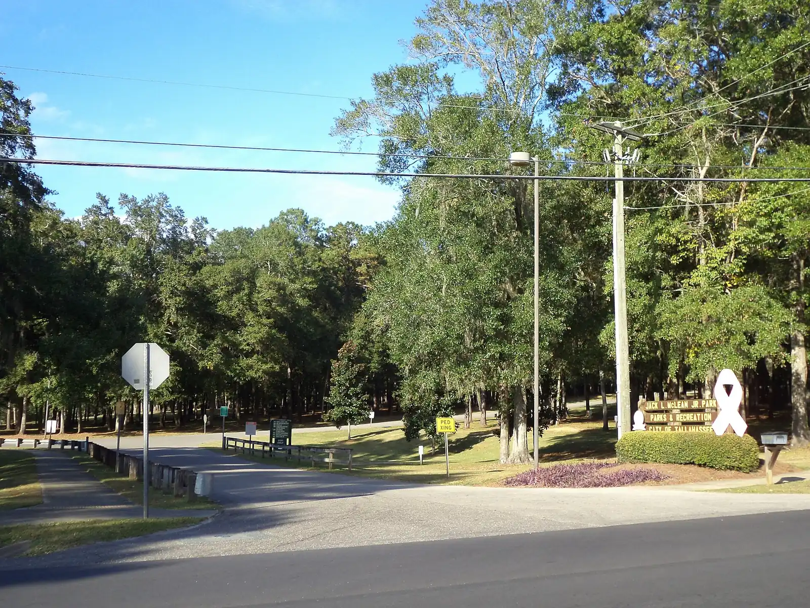
- Jack L. McLean Jr. Park, 700 Paul Russell Road, about 54 acres with trails, a playground, tennis courts and the Jack L. McLean Aquatics Center.
- Debbie Lightsey Nature Preserve, 1317 Capital Circle SW, about 116 acres with trails, including a mountain bike trail.
- Jake Gaither Center and Golf Course, 801 Bragg Drive.
- Walker-Ford Center and Pool, 2301 Pasco St.
- Capital Park, 400 Tram Road, about 20 acres with a playground.
- James Messer Fields, on Jackson Bluff Road.
- Tallahassee Junction Park, 1869 Mill St., about 20 acres with a trail.
- Anita Davis Preserve at Lake Henrietta Park, 3305 Springhill Road, a Leon County park of about 111 acres.
The county trail inventory maps the Tallahassee-St. Marks Historic Railroad State Trail, the FAMU Way and Cascades trails, the Lake Henrietta Trail and the Golden Aster Trail here. More is in our parks and trails guide.
Getting around
Measured on the road network from a point near the middle of the area:
- I-10 Exit 199, U.S. 27 (North Monroe Street): about 5.5 miles.
- City Hall, 300 S. Adams St.: about 3 miles.
- Tallahassee International Airport: about 5 miles.
These are distances, not drive times, measured with the OSRM routing engine on OpenStreetMap roads; the area is large, so they vary widely by address. StarMetro’s route pages show five weekday routes on the Southside: Big Bend (Southside Shopping Center and Crawfordville Highway), Gulf (Jake Gaither Community Center and South Monroe Commons), Live Oak (Orange Avenue), Moss (Orange Avenue, Paul Russell Road and Pasco Street) and Dogwood (Levy Avenue). More is on our getting around guide.
Neighborhood groups and HOAs
The city’s neighborhood registry lists about 20 active neighborhood associations inside the area, among them Greater Bond, Jake Gaither, Providence, South City, Liberty Park, Mabry Manor, Oak Ridge, Lakewood and Sherwood Park, and 10 active homeowner associations.
Groceries and everyday stores
OpenStreetMap maps few stores here. It places a Piggly Wiggly at 2526 S. Monroe St. inside the area. StarMetro’s route pages name Southside Shopping Center and South Monroe Commons Shopping Center as stops.
Related: Myers Park, walking and biking trails and moving to Tallahassee.
Frequently asked questions
What is the Southside Action Plan area in Tallahassee?
An area of about 14,300 acres south of downtown that the Tallahassee-Leon County 2050 Comprehensive Plan maps as Map 8. The plan’s Southside policies focus on beautification, investment and engaged citizens.
What high school is Tallahassee’s Southside zoned for?
About 77% of addresses are zoned for Rickards High (C for 2026), 14% for Leon High (B) and 9% for Godby High (incomplete), from Leon County Schools’ zone maps.
What is the typical home value on the Southside?
In ZIP code 32305 the Zillow Home Value Index was $195,582 in August 2026, and in 32310 it was $181,703. Those two ZIP codes hold about 61% of the area’s addresses.
Is all of the Southside inside Tallahassee city limits?
No. About 83% of its addresses are in the city and 17% are in unincorporated Leon County, on the county’s address map.
Have your say